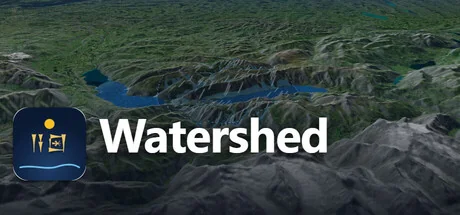
Watershed
Mozon
Rain on real terrain and watch the rivers run. Drain the oceans to the Ice Age and the Persian Gulf becomes a valley. Roll the atlas back to 3000 BC, then send a caravan across what remains. An educational sandbox on real elevation data, with its sources on every layer.
Системные требования
Минимальные требования
Рекомендуемые требования
Об этой игре
Weather
Six storm presets with their real order of magnitude, from a desert cloudburst to a monsoon week, or set every number yourself. Turn the rain up until the valley floors become lakes, then ease it off and watch them drain. Cloud shadows, rain and lightning play over readable ground, and a procedural soundscape follows the water.Ocean
Lower or raise the world sea level from 500 m below today to 80 m above, on real bathymetry. The Persian Gulf drains into a river valley, Dover joins Calais, deltas drown.Time
An atlas from 3000 BC to today: cities take their old names, peoples and empires move, roads appear and vanish. Every entry cites its source.Journeys
Place two flags and up to eight stops. A camel or ox caravan walks around the lakes and the sea of the chosen century, fords rivers where it must, stops at wells and cities, and tells you day by day whether the animals would survive.Honest
Every layer is real, public data with its source shown. Every number has a reason. It is a teaching instrument, not an engineering model, and the app says so.For classrooms
Share links reproduce a whole scenario, so a teacher can send a class the exact valley, storm, century and route to explore. Two ready 40-minute lesson plans with worksheets are included.Made by Mozon, a one-person studio in Dubai. Requires an internet connection for map and terrain data.
Поделитесь своим игровым опытом
Help other gamers! Share how this game runs on your setup, share tips, or ask questions.
Лучшие игры
Discover similar games you might enjoy based on genre and creator.

Отказ от ответственности
Информация об игре, изображения, описания и системные требования, представленные на этой странице, получены со сторонних платформ и не принадлежат Can I Run It. Мы не связаны с разработчиками, издателями или дистрибьюторами игр, не поддерживаемся ими и не имеем к ним отношения.
Can I Run It — это сервис проверки совместимости системы, который помогает пользователям определить, может ли их оборудование запускать определенные игры. Мы не продаем, не распространяем и не размещаем игровой контент.
Все товарные знаки, зарегистрированные товарные знаки, названия продуктов и названия компаний или логотипы, упомянутые здесь, являются собственностью их соответствующих владельцев.
Если вы считаете, что какой-либо отображаемый контент нарушает ваши права интеллектуальной собственности, свяжитесь с нами по адресу [email protected] с соответствующими подробностями, и мы оперативно рассмотрим ваши вопросы.